(Alamogordo NM)
Oliver Lee Memorial State Park sets at the mouth of Dog Canyon, about 24 miles south of Alamogordo. It has a wonderful view of the Tularosa Basin and the Sacramento Mountains. I spent a week there exploring.
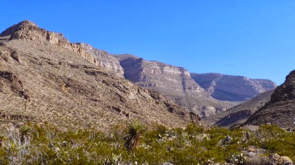
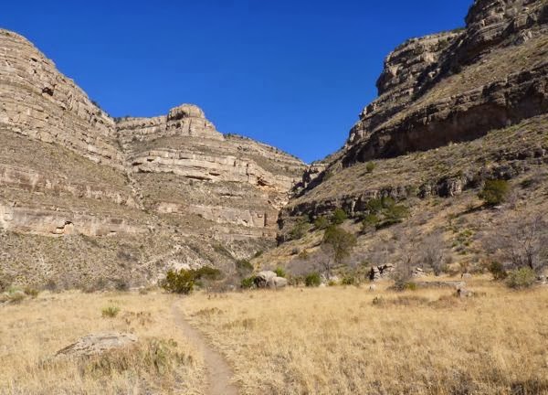
Mouth of Dog Canyon
One of the trails ascends up the canyon to an overlook about 3,000 ft above the park. That puts it at around 7,600 ft in elevation. It’s a steep climb up a well marked trail of 6.5 miles one way. I ventured up the Dog Canyon Trail, knowing I’d never make it to the top.
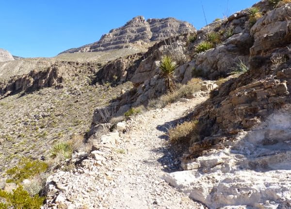
Early portion of trail
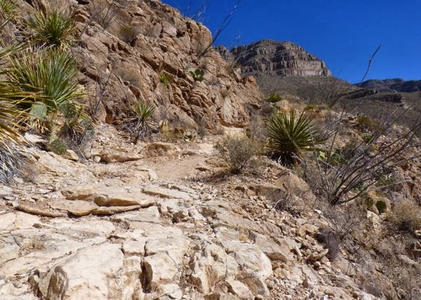
Rocky trail much of the way
The first leg of the hike was a quick 600 ft rise of switch backs to get past a prominence. Much of the trail was rocky, with drop-offs to one side. I regretted forgetting to bring my hiking stick along.
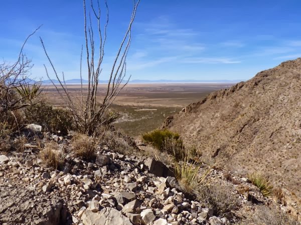
Looking west over Tularosa Basin
Once past the initial ascent, at a little over 1/2 mile, the trail flattens onto a bench. An easier hike across it brings you back toward the canyon. It begins descending a bit and a nice view of the Tularosa Basin can be seen looking west. Note the light line across the horizon; that is the White Sands National Monument area.
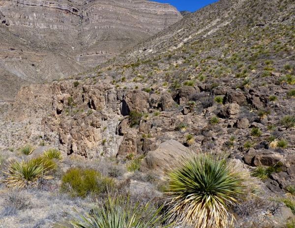
Large ravine to go around
More upward climbing on the trail for 1 3/4 miles takes you past a deep ravine. The trail skirts around the rim, and gives you a good view of the rocky streambed below. Then it continues up to a second bench.
Second grassy bench on trail
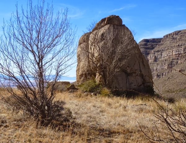
Huge boulder next to rim
A large flat grassy area makes a great place for back country camping. There was more than one spot with trees and large rocks for shade. One particularly big boulder rested on the rim. Just to the back side of it, the ground dropped off into the canyon below.
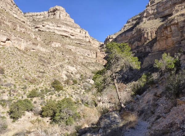
Trail next to edge with tree leaning out
Once again, the trail went up for a way, before starting down into the canyon. One side of the trail went steeply up, and the other side straight down. Just to the left of the tree in the photo was nothing but open air. At the end of the descent was the half-way point.
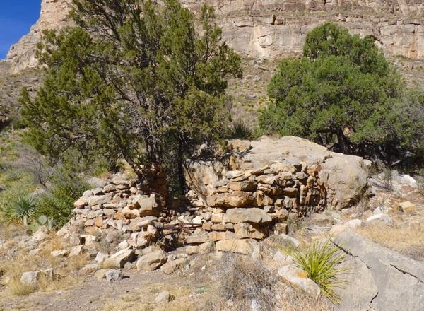
Ruins of cabin half way up
Across a spring fed stream are the remains of a rock cabin. It’s very near to the stream which was mostly in shadow from the adjacent cliff. Lots of juniper and dogwood trees, carrizo and grass crowded the rocky streambed. Water was flowing here, and there was even a pool that was frozen over.
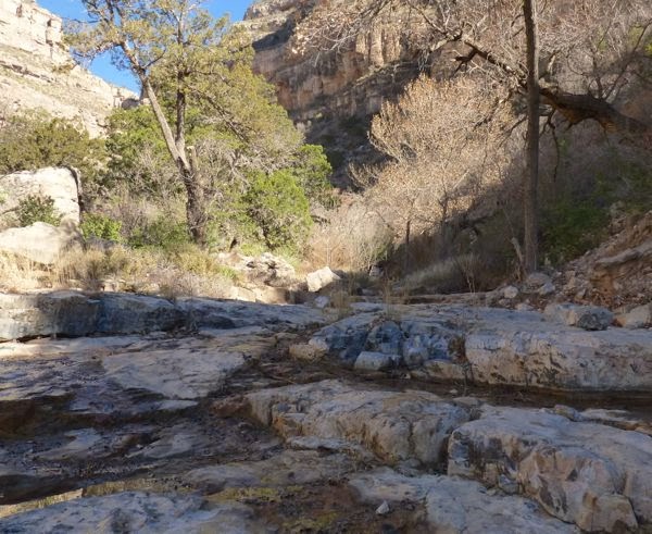
Spring fed stream near cabin
That was as far as I could go. About 1,500 ft increase in elevation, and almost 3 miles, took me 2 1/2 hours. A snack, with a few minutes of rest in this cool oasis, refreshed me for the return hike. I arrived back at camp in another two hours with aching muscles and a sense of accomplishment.
Camp: Oliver Lee Memorial SP
Scene: Mountains, canyon, desert, trails
Up to the ruined cabin and back is a good hike. The trail can be difficult beyond that, nit only because of the steep ascent but due to low maintenance, especially under the “eyebrow” where lots of junk falls on the path from further up.
Thanks for the info Ted. To the cabin was good enough for me. I was out of time and energy anyway.
that’s a tough trail. We only made it to the cabin, also, but that was plenty for a day hike. Our poles came in handy on the way down.
I agree on the hike difficulty. And, for sure that hiking stick I forgot would have been nice to have on the way down.
Nice photos of the area –
Thanks for the compliment. I try to get shots that are representative of an area.
Thank you for the excellent report. Apparently the cabin ruins are around 6000 feet so that would end my effort due to my altitude difficulties. I look forward to trying it soon.
Do as I did, and rest along the way. That makes it a bit more manageable.
One mile an hour is good time on that kind of trail, so I’d say you did really well. I don’t know how you made the descents without a hiking stick – you must be in way better shape than I am! (I’m trying to get in good enough condition to try an overnight backpacking trip from Butte Lake in Lassen in June.)
Wow! An overnight? Now that would be something to experience. I’m looking to be up that way around then. So, maybe we’ll see each other.
Have you checked out the NM Space History Museum in Alamogordo? We stayed at Oliver Lee when we went to the great museum. Love your photos and hike description. Thanks!
http://sockmonkeytrekkers.blogspot.com/2014/01/quartzsite-trial-run.html
I haven’t seen the museum yet. Thanks for the suggestion.
I can feel your hiking style. When I hike here on Maui in the Haleakala Crater I go very slow. I always am the last one to the cabin… but I get there. The neat thing about where you are is that there are towns above you in the Sacramento Mountains. Cloudcroft, Timberon and the National Solar Observatory (which has a sister observatory being built here on Maui) with some other places scattered about. You’re doing good, keep at it.
Thanks for the encouragement Jon. Finding the unexpected when exploring is exhilarating. I’m having fun!