(Moab UT)
While in Moab to visit the national parks, many other interesting possibilities were available. So, I took some time for a few side trips to explore the area. They provided wonderful views without the crowds.
Moab Side Trips Scenery
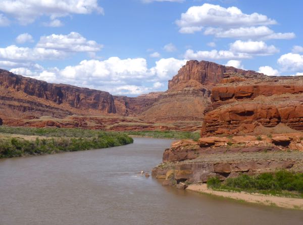
Colorado River East
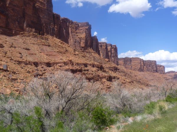
UT-128 was a paved highway following the Colorado River northeast out of town and had some great views of the river and cliffs. It also led to Fisher Towers which was accessible by 4-WD. Several BLM campgrounds were along the river, and all were full.
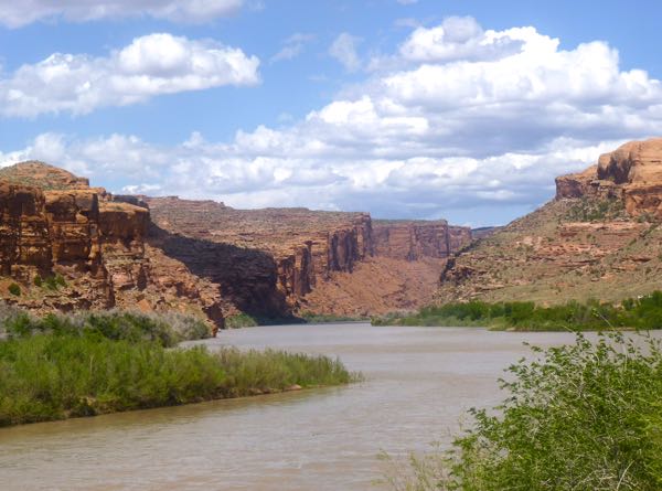
Colorado River east of Moab
Massive cliff near the river
Colorado River West
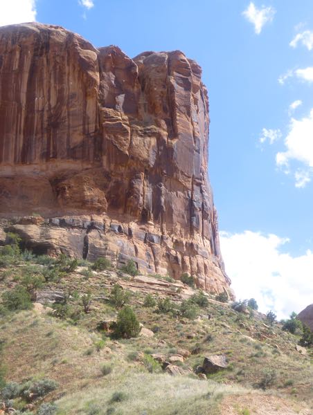
Potash Rd was UT-279, a paved road running adjacent to the Colorado River, that led southwest to a mine. Along the way were cliffs which rock climbers used, and some native rock art. The BLM camps along it were mostly full. A free boondock camp for the night, overlooking the river, was found at the very end.
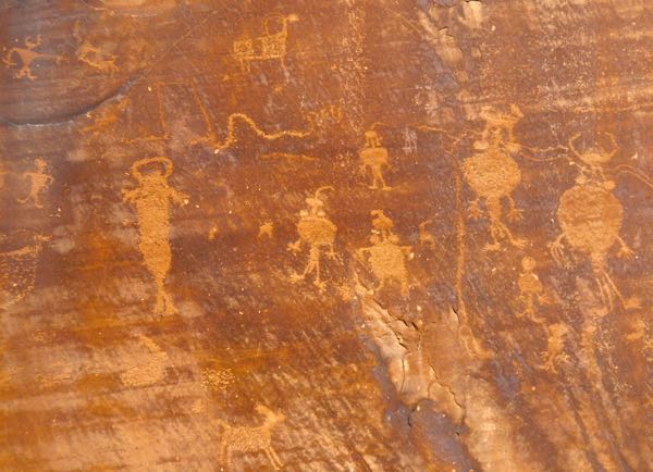
Petroglyphs next to Potash Rd
Colorado River west of Moab
Sevenmile Canyon
Another paved highway, UT-313 found north of town then going west, went to Canyonlands NP-Island in the Sky District. Several viewpoints with impressive scenes were along the way. This road also was the way to Dead Horse Point State Park.
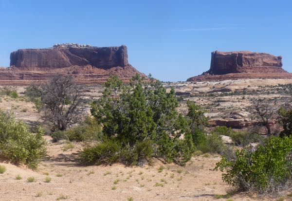
Monitor & Merrimac Buttes
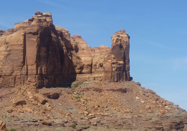
Cliffs along UT-313
Mill Canyon
A few miles north of town on US-191, then west about a mile on a gravel road took me to a stagecoach station ruin. Just some rock walls and a corral. Further up the canyon were supposed to be some dinosaur tracks. I didn’t venture that far. But, did find a nice boondock camp.
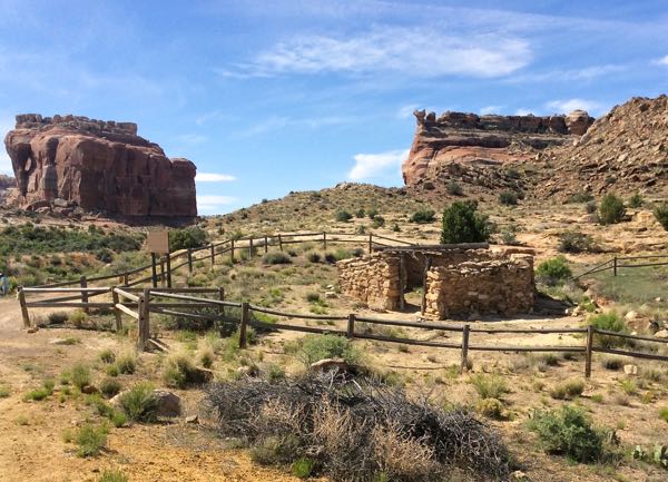
Halfway Stagecoach Station Ruin
Copper Ridge Sauropod Track Site
Going north some more on US-191, it was a bumpy drive in on the dirt two-track, through the Klondike mountain biking area, to the trailhead. But, a short hike to the track site. I guessed at what to photograph. Down the road aways, was another 3 mile trail to the Dinosaur Stomping Grounds with more footprints.
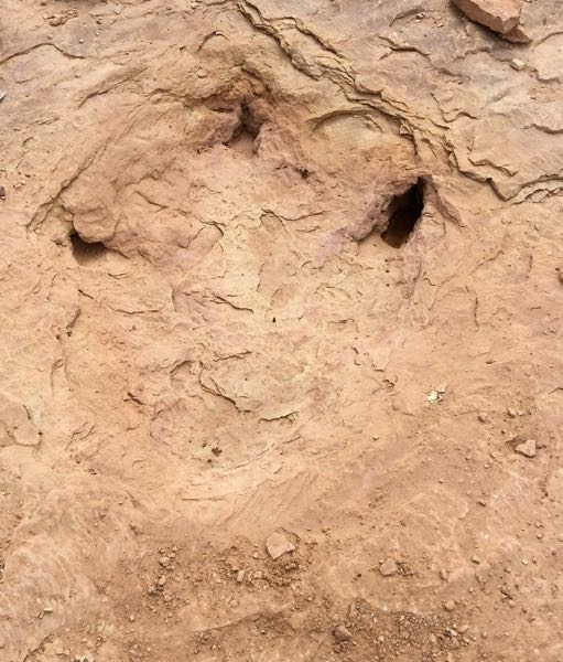
Dinosaur Track Fossil
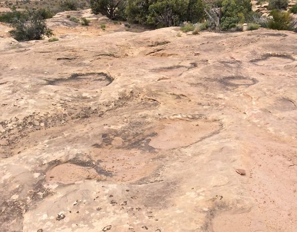
More dinosaur tracks
By looking around, I discovered much more than the national parks. For those into hiking, jeeping, mountain biking, rock climbing, rafting, and other outdoor adventures the Moab area offered much to delight.
Sites: Colorado River, Sevenmile & Mill Canyons, Dino Tracks
Scene: River, cliffs, buttes, petroglyphs, stage stop, dinosaur tracks
I subscribe to your blog and always look forward to your posts. I just love your pictures. I hope to retire in a few years and be able to explore many of the areas you describe. Thank you for allowing me to follow along on your travels, it fuels my dream.
Michelle
Thanks for following my journey, and for the kind words. It’s really great fun to see all these marvelous places. Best of luck with your travel plans. Hope you can make those dreams come true.